Ultra Race of Champions 100K Race Report
/The day began with fog and a frog. The frog had jumped onto the hood of my truck during the previous night’s drizzle. Perhaps to show off his skills at hopping several feet from the ground and sticking to smooth surfaces. Perhaps to distract and slow my morning progress as he required a gentle eviction from the hood.

Nice amber glow frogface
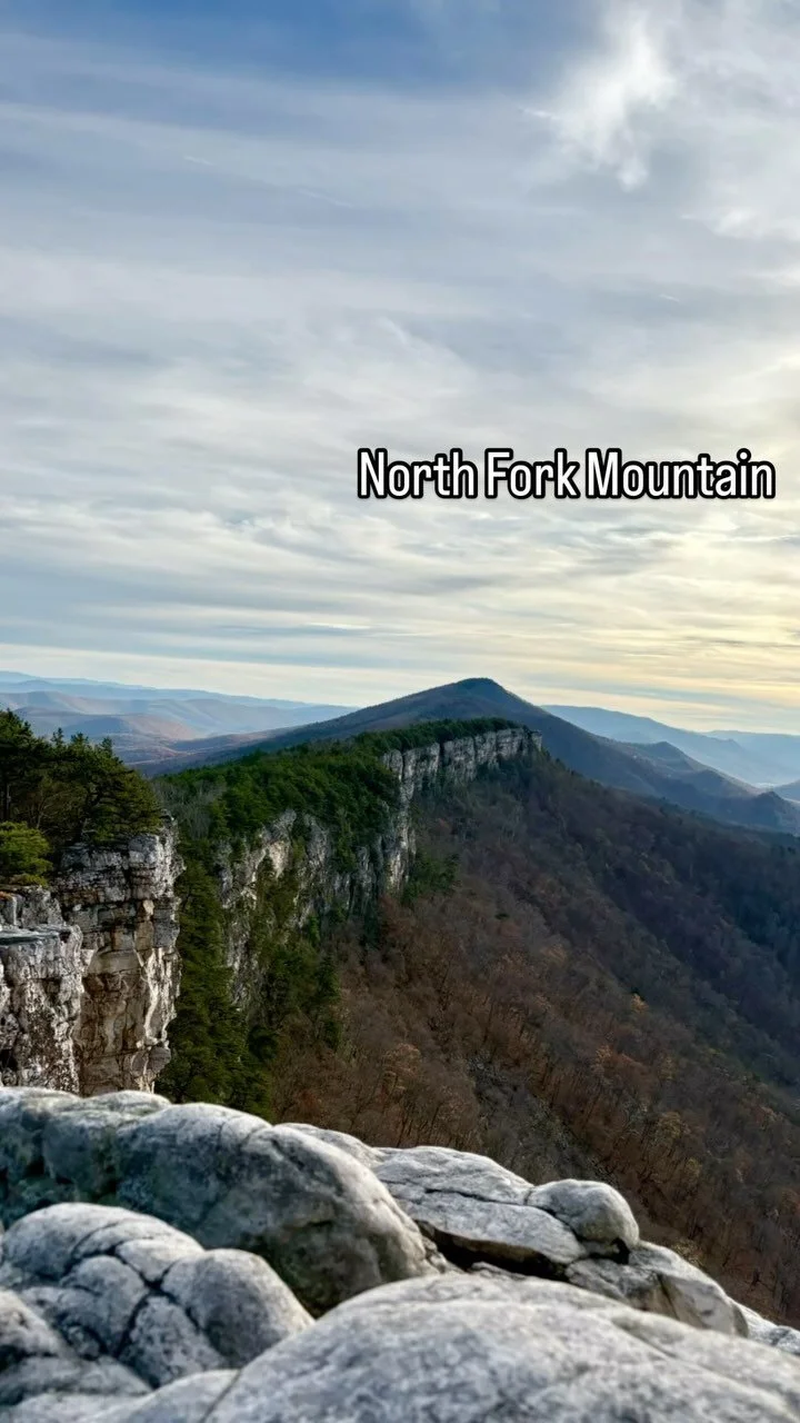
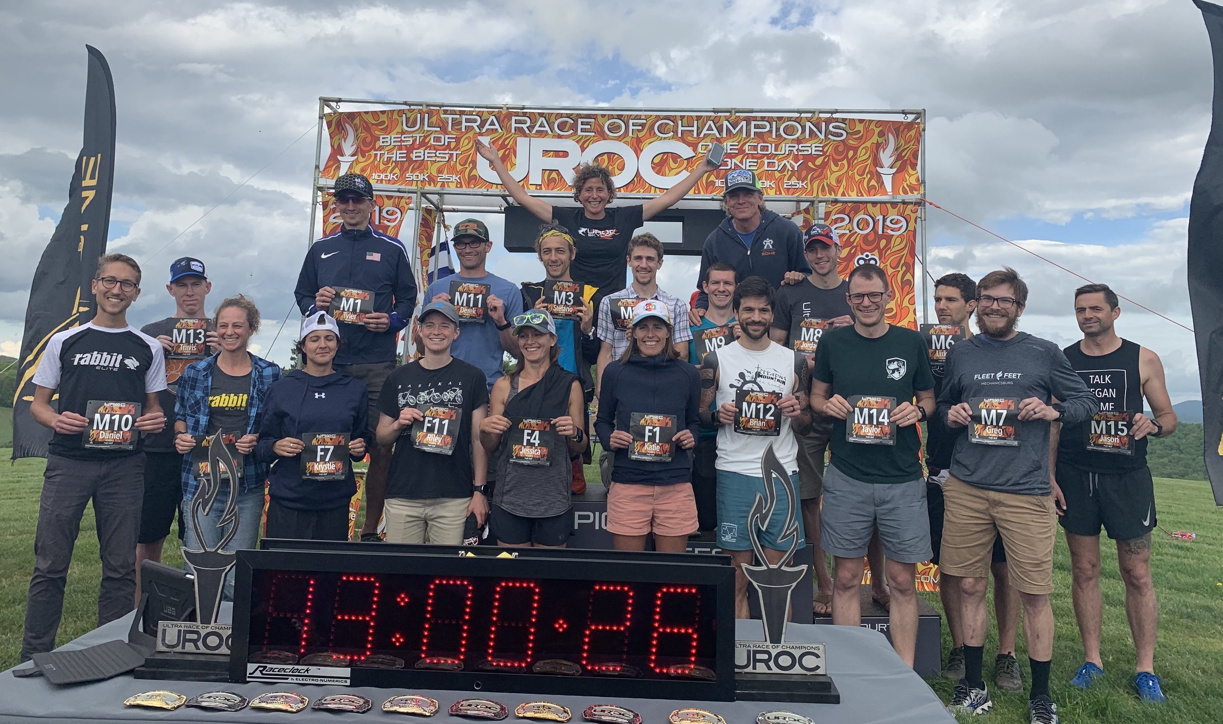
The Ultra Race of Champions 100K, otherwise known as UROC, has been held for eight years at various locations around the United States. The trend for the last three years has been to keep it in the Blue Ridge Mountains of Virginia’s George Washington National Forest. It has also been in notoriously awesome and historical trail running locations, such as: Auburn, CA, Breckenridge/Vail, CO, and Copper Mountain, CO. The organizers, Bad to the Bone Sports, offer a large, $21,400 prize purse, so it draws many more elite runners than a typical trail running race.
As nice as it would be, I certainly had no illusions of winning a part of that prize purse but wanted to aim for a solid day characterized by consistency in pace throughout the course. Sure, most folks are slowing at the end of an ultramarathon, but the idea is to keep it to a minimum.
Elite Bib Assignment. Courtesy http://www.territoriotrail.es/ultra-race-champions-uroc-gem-east-coast-elite-prize-purse-central-virginia/
Being on the same weekend, I initially debated between the closer Glacier Ridge Trail 50 Miler in PA and the UROC 100K, but I needed to get in a ton of challenging climbing and more distance in preparation for other upcoming events this summer. I prefer the wilderness setting of a national forest and the climbs were longer in VA, so I decided to go with UROC though I knew I’d be lucky to crack the top 10 overall there.
The more information you have going into long events, the fewer surprises and tough spots you’ll get into (so do some internet research). Google revealed only a few race reports to draw from though.
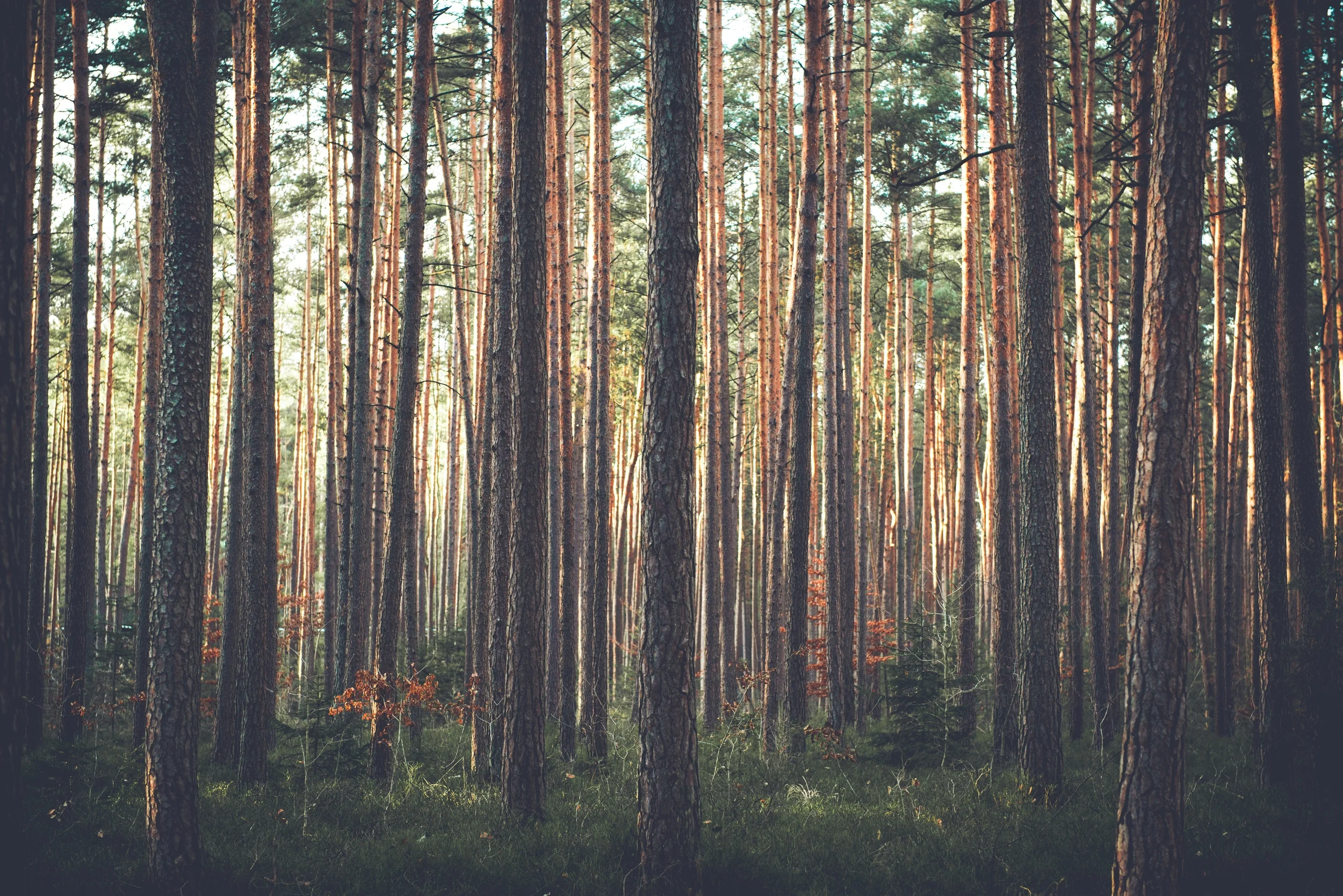
A partial solution to my ignorance was doing a little course recon after going to the University of Virginia Running Medicine conference in March. That was definitely helpful to get an idea of the typical trail surfaces, climb and descent grades, tree cover, road crossings, and general course design. If only I could have run the entire course because I still ended up surprised by the trail in the final hours of UROC. Another good option would have been to run the Bel Monte 50 Miler in March as it traverses some of the same trails.
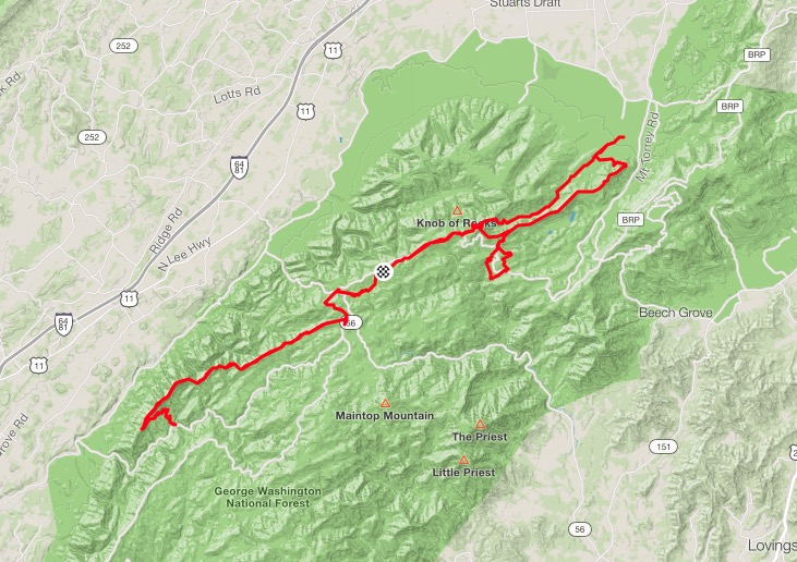
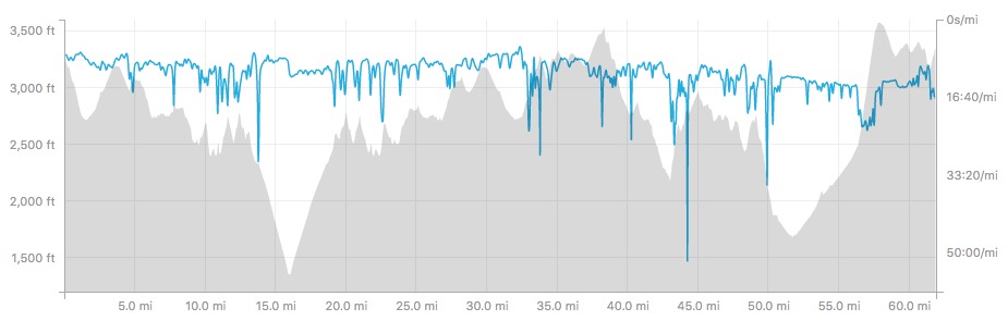
Let’s just say the UROC course is demanding, which is partly due to the >11,000 feet of climbing, but also because of the similar quantities of descending. It was the descending that would ultimately be my undoing.

Standing at the start line during this damp morning at Skylark Farm, where the races begin and end, I was greeted by fellow Morgantown trail runner Trevor Wolfe. The thing about ultrarunning is nobody needs to do a warmup run so we just stand around and bask in each other’s nervousness.
I was able to run and chat with Weirton friend Travis Simpson through the Blue Ridge Parkway and onto the Whetstone Ridge Trail, where we would gradually descend 1500’ for the next 11 miles. We were eventually joined by Leadville 100 women’s champion Katie Arnold for much of this section. Katie had never raced trails on the East Coast and being from Sante Fe, it was interesting to get her thoughts on the course as we moved along. I couldn’t tell if she was having more or less fun than the rest of us every time we’d get to a gnarly, steep, rocky section and she’d let out a yelp.
I had drifted away from the pack as I approached a slightly confusing intersection in the trail at mile 14. After gathering about eight runners, we decided on the most likely route downward and thankfully, were correct in our choice. I became a little too caught up in the flow of this part of the descent because I was at the front of that pack. It was narrow but non-technical so I’m sure a couple of us were moving at least 7:00/mile, if not quicker. I’ll never know - my GPS data was quite jacked up on this section. Still, we weren’t as fast as the leaders passing us that were returning from the aid station at the bottom of the climb. No one seemed to linger at that 16-mile aid long but I knew it was a lengthy, 11-mile uphill back to the next aid. Sure enough, on the way back up, the sun busted out, the temperature and humidity came up, and I had to give another runner water, so it was worth the 45 seconds to completely refill my hydration pack.
Even though it felt like less than two hours, now five hours deep, at the mile-28 aid station, I’m briefly humored by the fellow telling me that I’m maintaining a good pace and looking good but then asking me what I have wrapped around my ankles (gaiters) and whether I’ll take a 30-minute break to sit down. Apparently the leaders must have been in and out a little too quick for the interview.
I ran solo on a couple more miles of Parkway, plopping potatoes into the gas tank, as tolerated, then the hit the graveled Spy Run Road, then grassy paths back to Skylark where I was actually hot enough to pack ice under my hat. By the time I made it out to the next section of real trails off the Parkway at Bald Mountain, it was starting to rain, the sun was gone, and the temperature had dropped a few degrees again.
Back off road at mile 35 and happy to be running now on some of the trails that I’d previewed in March. The weather was chilly that day, but it was dry and clear with perfect visibility from the overlooks. Today it was strange to look out from the same vantage points to see nothing more than white, thick fog enveloping me and the trees. It almost felt like the edge of the earth was merely a few feet away, or that’s just weird stuff your brain conjures up 6.5 hours into a hard effort.

Before the Rains
The rain became harder and washed all the Nutella away. From my hands. Not from the earth because, oh my God, no one wants a world without Nutella. I bombed the lovely White Rock Falls Trail in the pouring rain, perhaps with a little too much pep in my step. But it was a ton of fun and flowy. Even after climbing some tremendous steepness back out of that ravine I was getting chilled and switched to a wool long sleeve upon returning to the Slacks Overlook aid station around mile 43. And wouldn’t you know the rain promptly stopped, and I began to overheat a bit again by the time I made it a couple miles away.
Onto the final descent on Torry Ridge Trail, the surface and grade were becoming increasingly brutal, resulting in the first real moment when I really felt “over it” and wanted to be done with a particular section. It was increasingly rocky and steep, so much so that my legs just stunk at controlling speed and keeping me in an upright position. I hadn’t been at an aid station for over an hour, so I probably just needed a hug or a teddy bear. Unfortunately, I’d left teddy in the truck to lighten my pack. I was forced to slow to my pace dramatically (which was clearly not part of the plan). It was intermittently raining, though nothing as heavy as the saturating downpours I’d come through on the Slacks Trail and White Rock Falls Trail. And then I almost stepped on this super bright yellow box turtle to shake things up a bit. “Watch where you are going, jerk!” (I’ll leave it up to the reader to decide which one of us said that). Thank goodness it was just a close call because I didn’t have my license, registration, or proof of insurance with me at the time. Turtle shell repair work is just so expensive these days.
FINALLY, the trail swings a hard left and becomes less damn rocky. Back to 9:00-10:00ish per mile pace for a few minutes. I’d wished I could have run that portion of the course beforehand. Had I known of its difficulty, I would have held back more in the White Rock Falls loop. But that’s all part of the adventure and challenge. I could still run the flattish or slightly uphill parts of the course at a good clip, even after mile 50, but any steep descending made my quads scream loudly enough to deem them untrustworthy.
There was a brief but nice ~2.5 mile total out-and-back dirt road section at mile 51 before the gradual ascending to the base of Bald Mountain on Turkey Pen Ridge Trail. The final mile of Turkey Pen was full of switchbacks and typically just steep enough that I couldn’t talk myself into shuffle running. I hiked it all at a consistent effort and was happy to be on it, though I was definitely starting to bonk a bit, which meant a more sideways wobble than forward hustle from time to time. The fog was insanely thick but helped prevent my grunts from echoing into the next county.
Coming into the final aid station at mile 58, I went for my reliable standard baby potatoes, a couple swigs of Coca-Cola, and a handful of chopped bacon. As I reached for my collapsible bottle from my vest to make a mix of watered down Coke, I realized that it was gone. Why me? Why now? Waaaaaahhhhh! No, I wasn’t actually that dramatic but I sure did like that bottle. Breakups are never easy. So, to whomever found the clear Nathan/Hydrapak bottle on Turkey Pen: enjoy the free gift but remember I kissed her first!

Obligatory watch check photo

Zombie transformation complete in less than one second
The volunteers here chatted back and forth about whether I should take a bottle that somebody had forgotten or dropped earlier. The one young woman said “there’s only four miles to go” and completely distracted by the fact that four miles sounded really small at the time, I took off without actually finding a substitute for what I was going to put in the bottle that I no longer possessed. I did not grab a gel as I had planned to do. Oops. Which means I started to really, really bonk as I headed back up the Parkway. It felt easier to run with my eyes closed, so I did. (FYI I don’t recommend running with your eyes closed, especially on the road. In heavy fog. Duh.) I think I could have taken a nap then pretty easily and I felt like I was kinda floating in the fog. Thanks hypoglycemia. I was pretty sure I wasn’t going to be caught by anyone else and I wasn’t going to do anymore catching, so it was more about finishing at this point. Hypoglycemia also makes you not care about, well, anything.
Generally, I really liked the course design. I would not have wanted to run all of the paved sections at once but having multiple broken sections of paved Blue Ridge Parkway to run was nice for a 15-20 minute mental break and develop another rhythm. Beyond mile 60, the Parkway eventually peaks out and gives way to the grassy and paved descent back toward the race start. As a I ran past the pond just below the peak of Skylark, I could hear just a couple peeps. Looks like the day ends as it began: with fog and a frog.

In the midst and the mist, I’d hoped to be closer to an 11:30 finish time but ended up in 12:03:12 with the 9th male position. There were about 118 people pre-registered but 69 finishers. If the 100K sounds daunting, there are 50K and 25K options to check out that would also make good precursors to the 100K.
Thanks to the volunteers, Bad to the Bone, and Anne (my solo crew member) for a well-supported and challenging day!